


Protected areas (PAs) in South America play a crucial role in safeguarding biodiversity and ecosystem services. However, the widespread presence of roads within PAs poses a major, yet largely overlooked, threat to their ecological integrity. In this study, we used the most recent version of OpenStreetMap to assess the extent and spatial distribution of road networks within South American PAs. We identified approximately 830,500 km of roads, a length equivalent to 20 times the Earth’s circumference, within 3,837 PAs (24% of the continent’s land area). By applying a 1-km buffer around all roads, we found that although about 83% of the protected land area remains technically roadless, it is dissected into nearly 25,500 discrete patches, more than half of which are smaller than 1 km², and only 6% exceed 100 km². Consequently, in six out of nine terrestrial biomes, the median distance from protected interiors to the nearest road is less than 3 km. Only remote regions, such as flooded grasslands and savannas, sub-Antarctic forests, and large portions of the Amazon basin, exhibit low road presence within PAs. Immediate conservation action is essential, with a focus on transparent road monitoring and management to preserve the ecological functions of these critical landscapes and ensure the long-term conservation of nature.

In the face of accelerating biodiversity loss, protected areas (PAs) have become a cornerstone of global conservation efforts. Over the past few decades, international frameworks, such as the Convention on Biological Diversity (CBD), have markedly influenced the expansion of PAs, both in geographic coverage and in the number of conservation units. In South America (one of the planet’s most biogeographically diverse regions and increasingly affected by human pressures) the PA network now covers around 24% of the continent’s land area, although with notable regional variations (Baldi et al., 2019). Recently, the CBD-Kunming-Montreal Global Biodiversity Framework set an ambitious new goal: to protect 30% of terrestrial ecosystems by 2030, often referred to as the "30 × 30" target. However, as PA networks continue to expand, so do the challenges they face from increasing human pressures (Jones et al., 2018). Among these pressures, road infrastructure stands out as a critical driver of multiple anthropogenic stressors, severely undermining PAs’ ecological integrity (Ibisch et al., 2016; Laurance and Arrea, 2017; Meijer et al., 2018; Barnes et al., 2017).
Roads pose a wide array of threats to natural ecosystems. They fragment habitats, alter land cover, and increase access for illegal activities such as poaching and logging. Additionally, roads introduce pollutants, disrupt natural fire regimes, and lead to biological and physical changes that degrade ecosystem health (Cappa et al., 2019; Ibisch et al., 2016; Laurance and Arrea, 2017; Laurance and Balmford, 2013; Trombulak and Frissell, 2000). Despite these well-documented threats, the full extent and spatial distribution of road networks within South American PAs remain poorly understood. This knowledge gap hinders effective spatial planning and management strategies, ultimately compromising the long-term success of PAs in maintaining biodiversity.
In this study, we present a comprehensive assessment of road networks within South American PAs, using the most up-to-date dataset from OpenStreetMap (OSM). Our analysis addresses three main objectives. First, we assess the extent and spatial configuration of road networks within PAs, using metrics such as road density, the proportion of roadless areas (defined as portions of PAs located at least 1 km from the nearest road; Ibisch et al., 2016), the median distance of protected interiors to the nearest road, the proportion of main roads, the density of access points, and the proportion of roads that dissect or incise the protected space. Second, we assess the role of road networks in driving habitat dissection within PAs (Jaeger, 2000). Finally, we compare the extent of roadless areas among PAs with stricter human-use restrictions (IUCN categories I–IV), those permitting sustainable use (IUCN categories V and VI), and those lacking formal IUCN classification. Spatial patterns are analyzed across major biomes (e.g., tropical moist forests, dry forests, grasslands, wetlands, and deserts) and countries to provide a continent-wide overview of the status of PAs in South America's diverse environmental contexts.
MethodsDefinition of protected areaAccording to the IUCN, a protected area (PA) is “a clearly defined geographical space, recognized, dedicated, and managed, through legal or other effective means, to achieve the long-term conservation of nature with associated ecosystem services and cultural values” (Dudley, 2008).
DatabasesPAs data. Terrestrial protected areas across South America were obtained from the March 2025 release of the World Database on Protected Areas (WDPA), maintained by the United Nations Environment Programme World Conservation Monitoring Centre (UNEP-WCMC) (https://www.protectedplanet.net/en). Following the WDPA User Manual and previous global studies (WCMC, 2019), we selected national-level polygon records with a status of "designated", "inscribed", "adopted", or "established", and with an area larger than 1 km², resulting in 4,015 records. Polygons smaller than 1 km² (n = 6,148) represented only 0.2% of the total protected surface in the continent. To avoid artificial fragmentation and overrepresentation of spatial metrics in contiguous protected landscapes, we applied a spatial dissolve operation to merge adjacent polygons sharing boundaries. This resulted in 3,837 spatially distinct protected areas (PAs), which we consistently refer to as the main analytical unit throughout the manuscript. While this differs from the original number of WDPA entries, it provides a more coherent and ecologically meaningful spatial framework for landscape-level analyses.
Road data. We used vector-based road data from the March 2025 release of OpenStreetMap (OSM), obtained via Geofabrik (www.geofabrik.de). OSM offers a detailed and up-to-date global coverage of road infrastructure, including all major and minor road classes. To validate our choice, we compared total mapped road length within South American PAs against the Global Roads Inventory Project (GRIP; Meijer et al., 2018), finding OSM to contain 5.5 times more road data.
Biome and national boundaries data. Biome boundaries were derived from the Ecoregions2017 dataset (©Resolve; available at: https://ecoregions.appspot.com/), which provides a globally consistent classification of terrestrial ecoregions. National boundaries were obtained from the high-resolution Global Administrative Areas database (GADM v3.6; available at: https://gadm.org/).
Spatial coordinate system. We adopted the Mollweide projection (EPSG: 54009) to (i) minimize area distortion across South America and (ii) enable consistent large-scale geographic comparisons at the global level, including regions such as Africa, Asia, and Europe.
Data ProcessingWe calculated all road infrastructure metrics within PAs using the PostGIS v3 extension for PostgreSQL and ArcGIS Pro 2.8. Extended Data Fig. S1 provides graphical representation of spatial characteristics of road infrastructure across PAs analyzed in this study.
Road density was computed as the total length of roads (in km) per 100 km² of PA surface. This metric reflects the overall intensity of road development within PAs, with higher values indicating potentially greater levels of habitat fragmentation and human disturbance.
Roadless area was defined as the portions of PAs located at least 1 km away from the nearest road, regardless of whether the road lies inside or outside the PA boundaries, following the approach proposed by Ibisch et al. (2016). This distance reflects a conservative estimate of road-effect zones, based on a systematic review showing that the majority of ecological impacts occur within 1 km from roads. Although certain effects may extend beyond this range, especially in the context of deforestation or large infrastructure, the 1-km threshold provides a continental consistent and ecologically meaningful proxy for identifying areas with low road influence (Ibisch et al., 2016).
Proximity to roads was calculated as the median Euclidean distance (in km) from grid cells within PA surfaces to the nearest road, regardless of whether the road lies inside or outside PA boundaries. To represent ecological pressure, this distance was inverted using the formula: 1 – distance, so that higher values indicate closer proximity to roads. This metric reflects the general accessibility of protected lands, as well as their exposure to edge effects and potential disturbances from human activities. To compute this, we used the “Euclidean Distance” tool in ArcGIS Pro 2.8, which generated a raster grid with 1 km² cells covering the interiors of PAs. Each cell value represented the shortest straight-line distance to the nearest road. The median value across cells was then extracted to summarize proximity.
Dissection ratio was calculated as the proportion of total road length within PAs that physically dissects their interiors, versus roads that penetrate the PA and terminate internally in end points (i.e., incisions). Higher values indicate potentially greater disruption of species movement and ecological connectivity.
Main roads was calculated as the proportion of total road length within PAs classified as “motorway”, “trunk”, or “primary” in the OSM tagging scheme, which typically represent the highest-capacity roads with greater ecological impact.
Access density was calculated as the number of road entry points intersecting PA boundaries per 100 km² of PA surface. This metric serves as a proxy for human accessibility to PAs, with higher values potentially indicating greater exposure to anthropogenic pressures.
To assess the extent to which road networks contribute to the dissection of PAs, we calculated and compared the Effective Mesh Size (EMS) (Jaeger, 2000) under two scenarios: (i) the PA network, which captures the spatial configuration and connectivity of the PA system in the absence of roads (hereafter, EMS PAs), and (ii) the roadless PA network, which includes only those PA portions located at least 1 km away from any road (hereafter, EMS PAs roadless), thus reflecting the dissection induced by road infrastructure.
Effective Mesh Size (Jaeger, 2000) is a probability-based metric that estimates the likelihood that two randomly selected points within a given area fall within the same undissected (i.e., connected) patch. It is formally calculated as:
where Aₜ is the total area of the network, Aᵢ is the area of the i-th patch, and n is the number of patches. This approach enables robust comparisons across regions with varying total area, offering a standardized measure of fragmentation.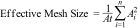
For EMS PAs, adjacent protected area polygons sharing boundaries were merged into cohesive spatial units by applying a dissolve operation (as described in the PAs data section). This process resulted in 3,837 spatially distinct PAs at the continental level.
For EMS PAs roadless, we applied a 1 km buffer around roads and extracted only the portions of PAs falling entirely outside this buffer. This process resulted in 25,473 discrete patches, representing areas with minimal direct road influence (see roadless area calculation). The same formula was applied, with Aₜ as the total roadless area, and Aᵢ as the area of each discrete roadless patch.
Finally, EMS values were expressed as a percentage of the total land area of each biome or country analyzed, allowing for consistent cross-regional comparisons of fragmentation levels relative to landscape extent.
ResultsThe extent and spatial configuration of road networksRoad networks were found to be extensive and widespread within South American PAs, totaling approximately 830,500 km (equivalent to 20 times the Earth’s circumference) and averaging 19 km of roads per 100 km² of protected land (Extended Table S1). Applying a 1-kilometer buffer around all roads, we found that although about 83% of the protected land technically remained roadless (i.e., outside the buffer zone), this space was highly fragmented (Fig. 1). Specifically, it was dissected into nearly 25,500 discrete patches, representing a sevenfold increase over the original 3,837 PAs. More than half of these patches (51%) were smaller than 1 km², and only 6% exceeded 100 km² in area. The median distance from the protected space to the nearest road was 16 km. Additionally, 74% of the roads dissected PAs by traversing them, while 26% penetrated without crossing, further contributing to internal fragmentation. Regarding road types, 11% were categorized as “main roads” (i.e., “motorway”, “trunk”, or “primary” roads in the OSM tagging scheme), designed for long-distance travel and thus facilitating deeper human access into PAs (Extended Table S1).
 and detailed views of roadless areas across South America. a, The study region. Green polygons represent PAs. Rectangles highlight the locations of inset panels (b–e), which provide detailed views of roadless areas (shown in green) in specific regions. Roadless area was defined as the portions of PAs located at least 1 km away from the nearest road, regardless of whether the road lies inside or outside the PA boundaries, following the approach proposed by Ibisch et al. (2016).")
Spatial distribution of protected areas (PAs) and detailed views of roadless areas across South America. a, The study region. Green polygons represent PAs. Rectangles highlight the locations of inset panels (b–e), which provide detailed views of roadless areas (shown in green) in specific regions. Roadless area was defined as the portions of PAs located at least 1 km away from the nearest road, regardless of whether the road lies inside or outside the PA boundaries, following the approach proposed by Ibisch et al. (2016).
The extent and spatial configuration of road networks within PAs varied markedly across South American biomes and countries. The highest road densities (112 km per 100 km²) and lowest proportions of roadless areas (49%) were observed in deserts and xeric shrublands (Fig. 2 and Extended Table S1), driven primarily by dense road networks in Venezuela, Chile, and Colombia (Fig. 3 and Extended Data Fig. S2). Mediterranean forests, woodlands & scrub, although exhibiting lower road density (63 km per 100 km²), also displayed low levels of roadless area (59%) and the highest values for main roads, access density, and dissection ratio (18%, 21 access points per 100 km², and 85%, respectively), indicating substantial human penetration into PAs (Fig. 2 and Extended Table S1). Notably, this vulnerability is further exacerbated by the biome’s critically low protection coverage, with only 2% of its total area formally protected (Fig. 2). Elevated road presence was also observed in PAs of tropical and subtropical dry broadleaf forests, where most countries, except Peru and Bolivia, exhibited roadless area proportions of approximately 50% (Fig. 3).
; Roadless area (proportion of PA surface ≥1 km from roads); Proximity to roads (1- median distance to the nearest road); Dissection ratio (proportion of road length that dissect PAs); Main roads (proportion of road length classified as motorway, trunk, or primary); Access density (road entry points per 100 km² of PA). As these metrics differ in units, they were log-transformed and rescaled to a common 0–1 range to enable comparison across biomes. For interpretative consistency, “roadless area” was inverted so that higher values indicate greater pressure. Percentages in parentheses next to biome names or the South America label indicate the proportion of the biome’s or continent’s total land area that is protected. Dashed lines in each radar plot indicate the corresponding values for South America, serving as a reference for comparison. Raw (non-transformed) values are available in Supplementary Table S1.")
Metrics of road infrastructure within protected area networks across South American biomes. Radar plots display six standardized metrics: Road density (km of road per 100 km² of PA); Roadless area (proportion of PA surface ≥1 km from roads); Proximity to roads (1- median distance to the nearest road); Dissection ratio (proportion of road length that dissect PAs); Main roads (proportion of road length classified as motorway, trunk, or primary); Access density (road entry points per 100 km² of PA). As these metrics differ in units, they were log-transformed and rescaled to a common 0–1 range to enable comparison across biomes. For interpretative consistency, “roadless area” was inverted so that higher values indicate greater pressure. Percentages in parentheses next to biome names or the South America label indicate the proportion of the biome’s or continent’s total land area that is protected. Dashed lines in each radar plot indicate the corresponding values for South America, serving as a reference for comparison. Raw (non-transformed) values are available in Supplementary Table S1.
 Roadless area within protected area (PA) networks across biomes and countries. Roadless area represents the proportion of PA surface ≥1 km from roads. Country names are indicated using ISO3 codes. (b) Total area protected. Bars represent the percentage of total land area under protection within each biome and country.")
(a) Roadless area within protected area (PA) networks across biomes and countries. Roadless area represents the proportion of PA surface ≥1 km from roads. Country names are indicated using ISO3 codes. (b) Total area protected. Bars represent the percentage of total land area under protection within each biome and country.
The road network substantially facilitates human entry into protected land. Notably, in 6 of the 9 biomes analyzed, the median distance from protected area interiors to the nearest road was within 3 km, underscoring the pervasive proximity of road infrastructure. The most extreme cases were found in deserts & xeric shrublands and tropical & subtropical dry broadleaf forests: excluding Peru and Bolivia, all other countries with PAs in these biomes reported median distances of ≤1 km between protected interiors and the nearest road (Fig. 2, Extended Data Fig. S2, and Extended Table S1).
In contrast, road networks were relatively sparse in flooded grasslands and savannas and in the large PAs of the Amazonian tropical moist broadleaf forests (Fig. 2, Extended Data Fig. S2, and Extended Table S1). However, this apparent roadlessness was not evenly distributed across countries. For example, although the tropical moist broadleaf forest biome reported an overall roadless area of ∼90%, country-level values varied widely: Paraguay (53%), Colombia (70%), and Argentina (73%). A similar pattern was observed in the flooded grasslands and savannas biome: despite a continental average of 83%, Ecuador and Venezuela reported only 31% and 64% roadless area, respectively (Fig. 3).
At the national level, the lowest values of roadless area were observed in Uruguay (42%), followed by Paraguay (65%), Colombia (70%), and Argentina (77%). These countries also exhibited low median distances from PAs to roads (<4 km). Uruguay, in particular, not only ranked lowest in roadless area but also showed the highest road and access densities (97 km per 100 km² and 19 access points per 100 km², respectively) (Extended Table S2). With the exception of French Guiana, road networks in all countries were dominated by segments that dissect the protected landscape (ranging from 55% to 77%), rather than roads that merely penetrate without dissecting (Extended Table S2). Across both countries and biomes, the hierarchical structure of road types within PAs reflected typical transportation classifications: a relatively small share of main roads designed for long-distance travel contrasted with a denser network of secondary, tertiary, and local roads, which collectively drive the extent of road presence in protected landscapes (Fig. 2, Extended Data Fig. S2, Extended Table S1 and Extended Table S2).
Road-induced dissection of protected areasTo further assess the contribution of road networks to habitat dissection within PAs, we analyzed and compared two key metrics: (i) the effective mesh size of the PA network (EMS PAs), and (ii) the effective mesh size of the roadless PA network (EMS PAs roadless). At the continental level, EMS PAs roadless represented only 1.15% of the South American land area, corresponding to a 68% reduction compared to EMS PAs (Fig. 4). This sharp decline reflects the substantial impact of road infrastructure on habitat connectivity, though it was partially buffered by the lower road infrastructure detected in large Amazonian PAs, particularly in Brazil, Peru, and Venezuela.
 Percentage of roadless areas by IUCN management category. IUCN categories I–IV represent PAs primarily designated for strict nature conservation. Categories V and VI correspond to areas allowing a greater degree of sustainable human use. “No category” refers to PAs lacking an official IUCN classification. (b) Road-induced dissection of protected areas (PAs). Green bars represent the Effective Mesh Size (EMS) of the PA network prior to accounting for roads (EMS PAs), reflecting its structural connectivity. Red bars indicate the EMS of PA roadless areas (i.e., areas located at least 1 km away from any road, EMS PAs roadless), capturing the degree of dissection caused by road infrastructure. Dots represent the percentage reduction in EMS attributable to roads, illustrating their impact on habitat connectivity.")
(a) Percentage of roadless areas by IUCN management category. IUCN categories I–IV represent PAs primarily designated for strict nature conservation. Categories V and VI correspond to areas allowing a greater degree of sustainable human use. “No category” refers to PAs lacking an official IUCN classification. (b) Road-induced dissection of protected areas (PAs). Green bars represent the Effective Mesh Size (EMS) of the PA network prior to accounting for roads (EMS PAs), reflecting its structural connectivity. Red bars indicate the EMS of PA roadless areas (i.e., areas located at least 1 km away from any road, EMS PAs roadless), capturing the degree of dissection caused by road infrastructure. Dots represent the percentage reduction in EMS attributable to roads, illustrating their impact on habitat connectivity.
However, biome-level analysis revealed substantial variation in the degree of road-induced dissection. In six of the nine terrestrial biomes, EMS PAs roadless values fell below 0.2% of their total land area (Fig. 4). The most pronounced dissection occurred in deserts & xeric shrublands (97% reduction in EMS when accounting for roads), tropical & subtropical dry broadleaf forests (80%), montane grasslands & shrublands (77%), and tropical & subtropical grasslands, savannas & shrublands (76%). These findings highlight that, despite differences in road densities, the spatial arrangement of roads within PAs can dramatically reduce habitat connectivity. Only the temperate broadleaf & mixed forests biome exhibited minimal PAs habitat dissection, with just a 10% reduction in EMS after accounting for roads (Fig. 4). This limited impact is likely explained by the unique geographical setting of many PAs in this biome, which are often located in remote, archipelagic, and rugged terrains that naturally constrain road development.
At the national level, Uruguay, Argentina, and Paraguay exhibited the highest degrees of PA road-induced dissection, with EMS PAs roadless representing just 0.04%, 0.10%, and 0.33% of their respective national territories, corresponding to EMS reductions of 80%, 63%, and 96%, respectively. Conversely, countries with vast roadless PAs, such as Brazil, French Guiana, Suriname, and Venezuela, maintained higher levels of landscape connectivity within their PAs (Extended Table S3).
Roadless areas across IUCN protected area management categoriesThe widespread presence of roads within South American PAs might initially be attributed to road networks in areas under less restrictive management categories. This pattern is clearer at the continental level, where roadless areas comprised 93% of the surface in PAs categorized as I–IV, 77% in categories V–VI, and 87% in PAs without formal IUCN classification. However, our analysis of roadless areas across IUCN management categories at the biome level revealed more nuanced patterns (Fig. 4 and Extended Table S4). Although PAs strictly designated for nature conservation (IUCN categories I–IV) generally showed higher proportions of roadless areas compared to those allowing greater human activity (categories V and VI) or those lacking formal IUCN classification, roads were prevalent across all categories in most biomes. Notably, exceptions to this pattern emerged. In flooded grasslands and savannas, PAs under categories I–IV had lower roadless area values than those in categories V and VI. Similarly, in tropical & subtropical dry broadleaf forests, tropical & subtropical grasslands, savannas & shrublands, and tropical & subtropical moist broadleaf forests, the extent of roadless areas in stricter protected categories was comparable to that of unclassified PAs (Fig. 4). At the national level, a similar trend was observed: although strictly protected PAs generally maintained higher roadless values, roads were still prevalent across all management types. An exception was found in Brazil, where PAs without an IUCN category (representing 40% of the total protected area analyzed for the country) had the highest proportion of roadless areas (Extended Table S4).
DiscussionGeneral patternsPAs are widely expected to have minimal road infrastructure for supporting local access, enabling sustainable economic activities, and facilitating territorial monitoring by park rangers (Dudley, 2008). However, our findings reveal a concerning reality: across a broad range of environmental contexts, management categories, and national territories, many PAs in South America are extensively permeated by road networks. This pervasiveness challenges the assumption that PA designation alone ensures ecological connectivity or effective isolation from anthropogenic pressures. At the national level, countries such as Uruguay, Paraguay, Colombia, and Argentina exhibited some of the highest levels of road infrastructure within PAs, resulting in the lowest proportions of roadless protected lands. At a biome level, only a few regions, such as flooded grasslands and savannas, tropical and subtropical moist broadleaf forests, and to a lesser extent, temperate broadleaf and mixed forests, retain PA networks with relatively low road densities and higher levels of roadless areas. This regional “roadless pattern” likely reflects the generally low human accessibility in the surrounding unprotected landscapes, rather than being a direct outcome of differences in PA management practices.
In contrast, PAs across dry forests, grasslands, deserts, shrublands, and savannas, which are ecosystems of high biodiversity value and crucial for providing ecosystem services (Khosravi Mashizi and Sharafatmandrad, 2023; White et al., 2000; McNeely, 2003; Zhang et al., 2023; Pennington et al., 2018; Murphy et al., 2016) are the most affected by roads. The ecological vulnerability of these biomes is further compounded by their alarmingly low protection coverage. Furthermore, these areas are not only subject to intense development pressures (e.g., infrastructure expansion and extractive industries), but also frequently overlap with productive agricultural frontiers, which are characterized by active land-use conversion, and with human settlements that bring localized and persistent pressures on ecosystems.
From a methodological perspective, our study utilized the most updated version of OpenStreetMap (OSM), which offers substantially greater coverage of South American road networks within PAs compared to other global datasets, for instance, 5.5 times greater than the Global Roads Inventory Project (Meijer et al., 2018) (see Methods). However, even this road dataset remains incomplete, particularly for informal, illegal, or undeclared roads. A growing body of research highlights the widespread omission of minor roads in available datasets, especially across tropical regions where human pressures are high. In the Brazilian Amazon, for example, recent studies using remote sensing and AI-based models have revealed substantially higher road densities than those captured in standard datasets (Botelho et al., 2022; das Neves et al., 2021). These so-called “ghost roads” have been shown to strongly predict forest loss and fragmentation (Engert et al., 2024; Barber et al., 2014). Notably, unmapped roads are not limited to the tropics: in boreal Canada, only 3% of randomly selected circular plots had roads fully mapped in OSM (Hoffmann et al., 2024). This growing evidence collectively underscores that our findings, though substantial, likely underestimate the full extent of roads, particularly in regions with lower institutional capacity, surveillance, and enforcement.
Ecological and conservation implicationsRoads exert influence beyond their immediate surroundings, causing a broad spectrum of direct and indirect effects on protected ecosystems. These include land-use changes, the spread of invasive species and diseases, chemical and physical pollution, poaching, and shifts in wildlife demographics, among others (Ibisch et al., 2016; Laurance and Arrea, 2017; Trombulak and Frissell, 2000). From a landscape ecology perspective, road networks are a major driver of habitat fragmentation. By dividing continuous habitats into smaller and often isolated patches, roads compromise ecological connectivity, essential for species movement, gene flow, and the maintenance of ecological processes (Fahrig, 2003; Fahrig and Rytwinski, 2009; Haddad et al., 2015). This fragmentation effect transforms PAs into ecological “islands”, limiting their long-term viability as conservation units.
No biome is immune to these pressures. For instance, in tropical forests, more than 95% of land-use change, fires, and carbon emissions occur within 50 km of a road (Barber et al., 2014). In arid and semi-arid regions, roads can lead to soil erosion, hinder species movement and communication, and facilitate the introduction of invasive species (Cappa et al., 2019; Dean et al., 2019). Additionally, genetic studies have documented reduced genetic diversity in populations isolated by road infrastructure in dryland environments (Ascensão et al., 2016; Holderegger and Di Giulio, 2010; Sunnucks and Balkenhol, 2015). Thus, pervasive road infrastructure within South America’s PAs presents an overlooked threat to the continent’s primary conservation strategy, which aims to “enhance the state of biodiversity by safeguarding ecosystems, species, and genetic diversity”.
Policy and management implicationsThe extensive road networks within South American PAs pose substantial challenges for effective conservation, underscoring the urgent need for coordinated and actionable strategies at regional and national levels (Mandle et al., 2015). These efforts align with Target 14 of the Kunming-Montreal Global Biodiversity Framework, which calls for integrating biodiversity into infrastructure and land-use decision-making across all sectors. Yet, it must be acknowledged that many of the recommendations for minimizing infrastructure impacts have been consistently highlighted in scientific literature for over two decades, with limited implementation. This persistent inertia reflects not a lack of knowledge, but rather a deficit in political will, inter-institutional coordination, and enforcement capacity. Without addressing these structural barriers, even the most technically sound solutions will continue to fall short.
A critical step involves embedding biodiversity concerns into national and regional infrastructure planning from the outset, particularly in countries where road infrastructure inside PAs is most extensive. Doing so ensures that development is harmonized with, rather than detrimental to, regional conservation priorities. Simultaneously, targeted conservation actions at the site level must be prioritized to address existing road impacts and restore ecological connectivity. One effective measure is the legal designation of roadless areas, also within ecologically sensitive areas, to help prevent further fragmentation and protect key habitats (Selva et al., 2015; Ibisch et al., 2016; Hoffmann et al., 2024). Beyond halting road expansion within PAs, it is also critical to regulate new road construction in remaining unprotected roadless patches, especially those adjacent to PAs, in order to avoid undermining their ecological function and connectivity. In areas already fragmented by dense road networks, restoration efforts are essential. These may include rerouting or decommissioning non-essential roads, as well as the creation of wildlife corridors to reconnect isolated habitats and reduce edge effects. Furthermore, seasonal road closures during critical ecological periods, such as breeding or migration, combined with public outreach campaigns, can reduce ecological disruption and foster broader societal awareness of road-related impacts (Selva et al., 2015; Loro et al., 2015; Ament et al., 2023; Hilty et al., 2020).
Equally important is the development of biome-specific management strategies that reflect the distinct ecological sensitivities and recovery capacities of different ecosystems. While high road densities were observed in PAs across all biomes, our findings indicate that dry forests, grasslands, deserts, shrublands, and savannas are particularly exposed to roads. These biomes are especially vulnerable due to their low resilience to disturbance and slow recovery following anthropogenic disruption (McNeely, 2003; Pennington et al., 2018). Conservation strategies must therefore be tailored to address these vulnerabilities, acknowledging both their ecological fragility and the limited attention they have received in policy and scientific agendas.
Moreover, our findings highlight the need to systematically reassess the extent of road infrastructure allowed within each IUCN management category. Despite advances in monitoring connectivity between PAs, there is a striking absence of indicators within the Kunming-Montreal framework that account for internal linear infrastructure. Addressing this gap is essential to enable countries to track and report progress more accurately under the Global Biodiversity Framework. Particularly concerning is the prevalence of roads in categories I–IV, which are designated for strict protection and minimal human intervention (Dudley, 2008). Even minor roads can cause significant ecological disruption by fragmenting habitats and restricting species movement (Donnelly and Marzluff, 2004; Boakes et al., 2009; Barnes et al., 2017). Meanwhile, categories V and VI, which permit sustainable use and human activities, often contain more extensive road networks. Although these categories accommodate human presence, there remains a pressing need to evaluate and potentially limit road development.
Striking a balance between economic development and environmental protection presents one of the most critical challenges for future conservation strategies. The 20th century and early decades of the 21 st have seen a dramatic expansion of road networks (Laurance, 2018; Ibisch et al., 2016). Projections suggest that by 2050, an additional 25 million kilometers of paved roads will be built compared to 2010, a length sufficient to encircle the Earth more than 600 times (Dulac, 2013; Laurance et al., 2014). This expansion is concentrated primarily in developing countries of the Global South, where environmental stakes and economic demands are high (Alamgir et al., 2017; Laurance and Arrea, 2017). In South America, this growth is largely driven by infrastructure serving agro-export economies, domestic consumption, and frontier settlement, adding significant pressures on ecosystems (Fearnside and de Alencastro Graça, 2006; Verburg et al., 2014; Carrero et al., 2020; Carpenter et al., 2025). While expanding PA coverage to 30% of terrestrial land by 2030 is a crucial milestone under the Kunming-Montreal Global Biodiversity Framework, it is increasingly evident that spatial expansion alone will not guarantee conservation success. Preventing unauthorized road construction and halting infrastructure proliferation across all PAs is thus essential to ensure their core mission: safeguarding biodiversity and securing the ecosystem services on which human societies depend.
CRediT authorship contribution statementAll authors made substantial contributions to the conception or design of the study. S.A.S., E.G.J., and G.B. conceived and designed the study, with contributions from J.P. and W.F.L. S.A.S. acquired the data and conducted the analyses. S.A.S., E.G.J., J.P., W.F.L., and G.B. interpreted the results, contributed to drafting the manuscript, and approved the final version for publication.
Data availabilityAll input datasets used in this study are publicly accessible. Biome boundaries were sourced from Ecoregions2017 (available at https://ecoregions.appspot.com). Terrestrial protected areas were obtained from the March 2025 release of the UNEP-WCMC World Database on Protected Areas (https://www.protectedplanet.net/en). Country boundaries were retrieved from the GADM 3.6 database (https://gadm.org). Road data were obtained from OpenStreetMap via Geofabrik’s regional extracts (www.geofabrik.de), accessed in March 2025. The spatial datasets of derived metrics (i.e., GIS layers containing road infrastructure metrics generated through the processing and analysis of these input layers) are available from the corresponding author upon reasonable request.
The authors declare no competing interests.
We thank A. Persia for her assistance with graphic design and the reviewers and editors for their constructive comments.
The following is Supplementary data to this article:


